
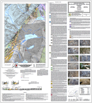
The Maine Geological Survey is pleased to announce the publication of a new bedrock map, Bedrock geology of the Big Machias Lake quadrangle, Maine, by Dr. Chunzeng Wang, a professor at the University of Maine at Presque Isle. This is the latest map to be published from a multi-year effort to map the geologic region in Northern Maine known as the Munsungun Inlier, an area of pre-Devonian volcanic and sedimentary rocks surrounded by Devonian sedimentary cover rocks.
The Big Machias Lake quadrangle hosts the northwestern edge of the Munsungun Inlier and the southern tip of the Winterville Inlier, a similar geologic region to the north. Several long (>10km) northeast-striking faults cut across the Munsungun Inlier in this quadrangle, as well as several late northwest- and east-striking faults. In the northwest corner of the quadrangle, the map is dominated by the Devonian Seboomook Group sedimentary cover rocks. In the southeast half, the dominant rocks are the Ordovician Rowe Lake Formation sedimentary rocks. In between are Silurian to Ordovician volcanic rocks of the newly named Rocky Brook Mountains and Ingalls Brook Road formations, mostly in fault contact with the surrounding sedimentary rocks. Two newly acquired ages are reported on this map, a detrital zircon U-Pb age of 447.0 ±3.2 millions of years before present for the Rowe Lake Formation conglomerate member, and an igneous zircon U-Pb age of 456.6 ±1.8 millions of years before present for the tuff member of the Ingalls Brook Road Formation.
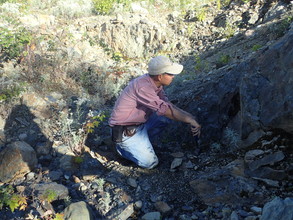 |
Dr. Wang examining the bedrock in the North Maine Woods.
Bedrock maps provide a basic information source that can contribute to understanding groundwater quality, groundwater flow and contaminant transport, soil chemistry, distribution of mineral resources, engineering properties relevant to construction projects, and the history of the earth.
No comments:
Post a Comment